

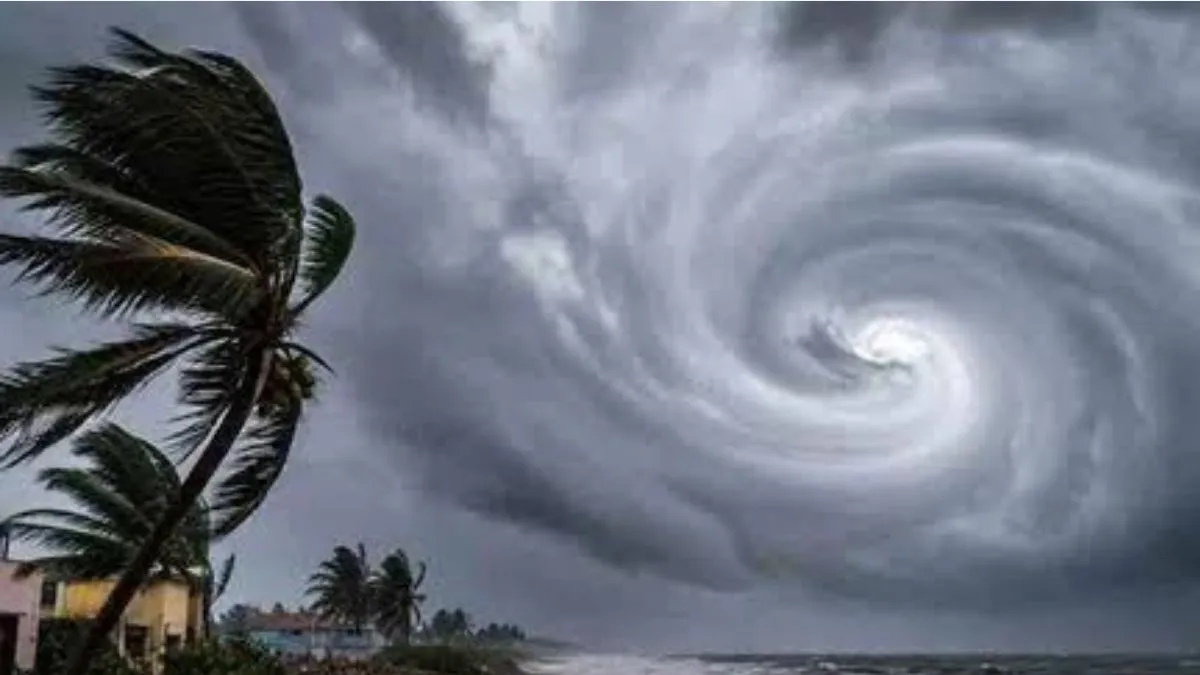
Tracking Cyclone Arnab: Origin, Meaning, and the Regional Alert
As a low-pressure disturbance over the Bay of Bengal intensified into a severe weather system, meteorological tracking stations across South Asia shifted into high gear. Christened Cyclone Arnab, the system has steadily strengthened over warm oceanic waters, with satellite imagery capturing tightly wound convective cloud bands and an organizing central circulation.
With the system advancing toward the east coast of India, the India Meteorological Department (IMD) issued red-level alerts for Andhra Pradesh and south Odisha. Landfall expectations and squally weather have sparked public interest not just in regional safety measures, but also in the mechanics of how such tropical storms receive their identities.
What Does the Name Arnab Mean?
The name Arnab (pronounced Ornab) is derived from Bengali (with roots in Sanskrit), where it traditionally translates to the sea or ocean.
While the official meteorological nomenclature registry documents the proposing nation and official pronunciation guide, it does not assign interpretive symbolic weight to the storm itself. The title does not signal the storm’s eventual severity, wind speed, or path; atmospheric conditions dictate its real-world trajectory.
Who Named Cyclone Arnab and How Did It Enter the Registry?
Bangladesh proposed the name Arnab. It is part of the comprehensive regional matrix adopted in April 2020 by the World Meteorological Organization (WMO) and the United Nations Economic and Social Commission for Asia and the Pacific (UN ESCAP) Panel on Tropical Cyclones.
Under this framework:
- 13 member countries participate: Bangladesh, India, Iran, the Maldives, Myanmar, Oman, Pakistan, Qatar, Saudi Arabia, Sri Lanka, Thailand, the United Arab Emirates, and Yemen.
- Each country contributed 13 distinct names, yielding a master catalog of 169 names.
- Names are arranged sequentially and adopted column by column across member nations alphabetically.
A common misconception is that the country providing the name is either the storm’s origin or its intended destination. The proposing country has no bearing on where a storm forms or makes landfall. A name submitted by Bangladesh can track toward the Andhra Pradesh or Odisha coastline, or navigate anywhere across the North Indian Ocean basin.
The North Indian Ocean Cyclone Naming System
Naming protocols for the North Indian Ocean—which encompasses both the Bay of Bengal and the Arabian Sea—began operationally in September 2004 with an initial group of eight nations. In 2018, five additional countries joined the panel, culminating in the 2020 expanded list.
Storm Formation / Deep Depression
              │
              ▼
Sustained Winds Reach ≥ 34 Knots (62 km/h)
              │
              ▼
RSMC New Delhi Assigns Next Sequential Name
              │
              ▼
Disaster Response & Public Bulletins Issued
The Regional Specialised Meteorological Centre (RSMC) in New Delhi, operated by the IMD, is responsible for monitoring cyclonic developments in this maritime zone and formally assigning the next scheduled title from the roster once sustained surface wind speeds reach or exceed 34 knots (62 km/h).
Unlike Atlantic hurricane names, which are recycled every six years unless a particularly destructive storm’s name is retired, names in the North Indian Ocean registry are used only once and retired permanently upon use.
Strict Guidelines for Regional Cyclone Names
To maintain international diplomacy and effective public safety, member nations adhere to rigorous criteria when submitting candidate names:
- Neutrality: Names must remain strictly neutral regarding politics, religious beliefs, cultures, or gender.
- Brevity & Clarity: A name must be easy to pronounce for diverse populations and cannot exceed eight letters.
- Tone: It must not cause offense or hurt the sentiments of any community across the 13 participating states.
Why Cyclones Receive Names
Assigning human-comprehensible names to tropical depressions serves operational, administrative, and safety functions:
- Clarity in Multi-Storm Situations: When multiple oceanic disturbances form concurrently in the same oceanic basin, names prevent technical mix-ups among forecasters, maritime operators, and emergency relief services.
- Rapid Public Communication: Distinct names are far simpler to remember than latitude-longitude coordinates or technical tracking numbers, speeding up the dissemination of evacuation advisories and shelter locations.
- Media & Archival Accuracy: Standardized terminology minimizes erroneous reporting across print, digital media, and scientific databases, preserving a clean historical record of storm tracks and disaster relief responses.
Impact Zones: Coastal Alerts and Inundation Risks
As Cyclone Arnab nears landfall, regional disaster management authorities (NDRF, SDRF) have placed emergency squads on standby, readying shelters and setting contingency measures in vulnerable coastal and interior districts.
| Geographic Sector | Expected Meteorological Impact | High-Risk Locations / Districts |
| Direct Landfall Belt | Severe cyclonic impact, high-velocity winds, destructive coastal surge | Bapatla, Visakhapatnam (Vizag) |
| Andhra Coastal Corridors | Very high wind speeds, heavy to extremely heavy downpours, localized inundation | Dr. B.R. Ambedkar Konaseema, Kakinada, Anakapalli |
| North Coastal Andhra Pradesh | Intense precipitation belts, gusty squalls, flash flood risk | Vijayawada, Vizianagaram, Srikakulam |
| South & Coastal Odisha | Torrential rainfall, potential river swelling, wind-driven structural hazards | Ganjam, Gajapati, Rayagada, Koraput, Malkangiri, Puri, Nabarangpur |
| Tamil Nadu & Puducherry Coast | Peripheral outer bands, persistent showers, localized street waterlogging | Chennai, Puducherry |
| Interior Central & Eastern India | Moisture influx leading to steady rainfall, gusty squalls, disrupted transport | Chhattisgarh, Jharkhand, Bihar, Eastern Uttar Pradesh |
Residents across these regions are advised to monitor official daily bulletins issued by the IMD and state disaster management authorities, strictly avoid venturing into the open sea, and heed local evacuation protocols until the weather system has fully moved inland and weakened.